
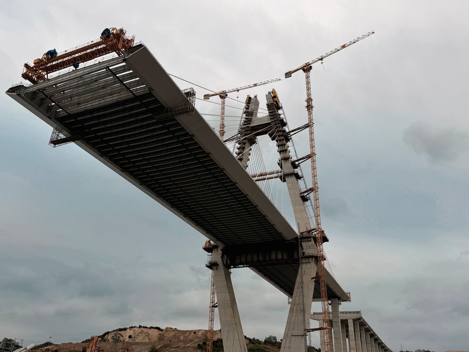
Every rainy season in Dar es Salaam, a short stretch of Morogoro Road at Jangwani decides the fate of thousands of commutes. When the Msimbazi River rises, floodwater sweeps across the carriageway, buses stop, and the corridor that links the city centre with its western suburbs grinds to a halt. The answer now rising above the muddy valley is the Jangwani Bridge: a 390 metre elevated crossing set eight metres above the existing road level, designed so that traffic keeps moving even when the river below bursts its banks. The Tanzania National Roads Agency said in August that construction had reached 41 percent.
The Jangwani Bridge is the centrepiece of the Msimbazi Basin Development Project, a resilience programme that Tanzanian authorities value at around US$260 million. The World Bank’s International Development Association is providing US$200 million in concessional financing, with Spain and the Netherlands contributing additional funds, according to Inter Press Service.
How the Jangwani Bridge Is Being Built
The bridge will run roughly 390 metres across the floodplain, within a wider construction corridor of about 1.2 kilometres that includes approach roads. It will be approximately 41 metres wide, carrying general traffic, pedestrians and cyclists alongside the city’s Bus Rapid Transit system.
The structure rests on deep foundations driven through soft floodplain soils. Project manager Leonard Ngayungi told IPS that the bridge is supported by hundreds of piles between 35 and 42 metres deep, depending on soil conditions. Of the roughly 496 piles required, 404 had been completed, according to officials.
The design logic is simple. The old crossing was a low bridge of just 47 metres with limited clearance, and the road sat inside an active floodplain. The new bridge takes the transport infrastructure above the flood level instead. “We are changing that relationship by taking the transport infrastructure above the flood level,” Ngayungi told IPS, adding that the bridge is designed so the river can flow perpetually underneath while people, buses and other vehicles continue moving above.
He said the team is designing for the rainfall of the future, not the rainfall remembered from 20 or 30 years ago.
River improvement works accompany the bridge. World Bank project documents describe raising and widening the Jangwani crossing, building raised embankments of about 680 metres, and excavating the riverbed during construction to improve stormwater conveyance. Parts of the lower basin are intended to become flood detention areas that temporarily hold excess water.
Why the Jangwani Bridge Matters
Dar es Salaam is East Africa’s largest city, with more than seven million residents, and the Msimbazi basin alone is home to about 1.6 million people. Two of the city’s major traffic arteries cross the lower floodplain near Jangwani, including the corridor used by the city’s first Bus Rapid Transit system. When the river floods, the damage spreads far beyond households beside the banks: roads close, buses stop, workers arrive late, traders lose customers, and goods cannot move easily between the city centre and western suburbs.
The flooding problem is not only about rain. Rapid urban growth has pushed settlements into wetlands and floodplains, while buildings and roads have reduced the land available to absorb rainwater. About 70 percent of Dar es Salaam’s residents live in informal settlements, many with inadequate drainage. IPS cites World Bank figures showing that a major flood in the Msimbazi basin in 2018 caused an estimated US$100 million in damage, about two percent of the city’s gross domestic product.
A BRT driver on the Kariakoo to Kimara route told IPS that heavy rain can turn a routine journey into hours of uncertainty, since drivers cannot gamble with a bus full of people when water is crossing the road. If the elevated crossing works as designed, rain will no longer force the whole route to stop because of Jangwani.
What Happens Next
The wider Msimbazi project is scheduled to run through 2028. TANROADS is responsible for the bridge works, while other government institutions handle the redevelopment of the valley around it.
Around 3,500 households living in the Msimbazi floodplain were targeted for resettlement, with US$30 million allocated for compensation, according to IPS. Authorities also envisage markets, commercial development and improved public transport in the redeveloped valley, and parts of the lower basin are intended to become a wetland city park that attenuates stormwater.
Urban planners warn the bridge alone is not enough. Deusdedit Rwehumbiza, an urban planning professor at Mkwawa University, told IPS that the project’s strength is treating flooding as a land use, environmental and transport problem at the same time, but that success will also depend on controlling waste, sediment and development upstream. “You can build a bridge to last many decades,” he said, “but the river is connected to everything happening upstream.”
The commuter’s test will come on a rainy morning when the Msimbazi rises.